Puget Sound Lidar Consortium
Parent
Home
| About
Lidar | About
the PSLC | Data
| Uses
of Lidar data | Links
| Contact
us
LiDAR tiles have been mosaicked into large file geodatabases for
convenient
use. This format can now be accessed only through version 9.2 ESRI
software.
In 2008, ESRI will publish the API so that other vendors can write
interfaces
in their software for this format. File geodatabases are more compact
than
SDE databases and--when the user load is low--much faster.
(File geodatebases supplant "personal geodatabases". ArcMap 9.1 cannot
read file geodatabases.)
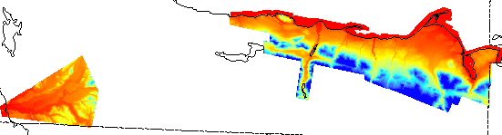 This is the Clallam survey.
Downloading 2.5 GB is complicated.
- Download the clallam2005 database
directory with its smaller files
and unzip it into the place where you want it.
- Then download
a00000028.gdbtable into the clallam2005.gdb directory which you
created
Warning: Internet Explorer has failed on files larger than 2
GB.
Netscape works. And very old FAT (new windows filesystems are NTFS)
filesystems
cannot handle large files.
- Select the .gdb directory in ArcMap:AddData or in ArcCatalog. It
should contain one grid. Have fun with it.
- Delete partofgdb.zip (unless you had unzipped it on the fly)
A check reveals that this is actually data from 2001-02. The
filegeodatabase
will soon be altered to show this.
See the
Clallam County page in the
the
project page