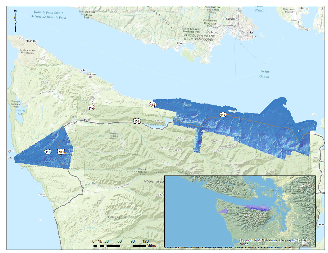
Puget Sound Lidar Consortium

Home | About Lidar | About the PSLC | Data | Uses of Lidar data | Links | Contact us


2001-2002 Clallam County Project


Description:
This dataset was flown through a Clallam County contract that had similar technical specification as the PSLC.  The only difference was that this data had 30% overlap from flightline to flightline.  The PSLC specifies 50% overlap, which results into 100% double coverage.  The data extends from the northeastern corner of the county to an area past Joyce.  It also cover an area in the vicinity of Forks to La Push.  The DEM grid cell size is six feet. The elevation units are in feet. The data is in Washington State Plane North Coordinate System FIPS 4601, in the NAD83(HARN)/NAVD88 datum.

Back to Data by Projects

Reference Information:
This information is provided to be used in conjuction with the LiDAR datasets.

Read-Me file
Project Map
Project Area and Index files (Shapefile)
Trajectory Files
Frequently Asked Questions
      
Data:
The raster data is available in either USGS quarter quads and as a Mosaic.  The elevation data in quarter quads is in the
ArcInterchange .e00 format.  The raster elevation data is also available as a mosaic ArcGIS 9.x file Geodatabase.  The file Geodatabase includes raster datasets for the bare earth and the top surface. The point data is available in ASCII text format.  Point data is only available by tile.  A tile is a 1/25 section of a USGS quarter quad.  For details on the subdivisions of this data see the Index shapefiles in the Reference Information section above.

Data by USGS Quarter Quad/Tiles Individual Files DEM Index Map Topographic Image
Index Map
Bare Earth - 6 ft raster resolution
--
Top Surface - 6 ft raster resolution --
Bare Earth Point ASCII files


All-Returns ASCII files


Raster Mosaic Data


File Geodatabase Mosaic


Back to Data by Projects


Update Policy 
As we approve data from the contractor they are posted here. Areas within many of the bare-earth DEMs can be improved by further processing of the all-return point data to better isolate bare-earth points. As we make these improvements we will upgrade the bare-earth DEMs and derivative images posted here.

Technical Assistance
If you have difficulty loading the data files into your software, cannot easily transfer large files via the Internet, or would like advice on the uses and limitations of these data, please reference our frequently asked questions.  If you can't find what you need here contact us.

This page maintained by PSLC webmaster