Puget Sound Lidar Consortium

Home | About Lidar | About the PSLC | Data | Uses of Lidar data | Links | Contact us


GlacierPeak2015
  map
   
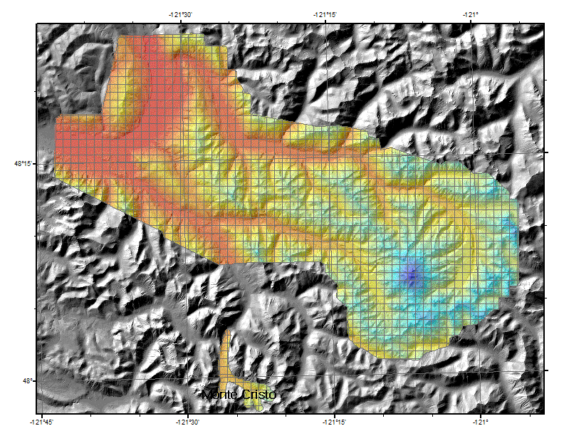
GlacierPeak2015
This survey was done by the USGS and rasterized at one-meter resolution. It includes the Suittle and White Chuck Rivers, and a smaller section of the South Fork of the Sauk approximately from Monte Cristo north to Monte Cristo Lake. Acquisition ran from 08/25/2014 to 6/24/2015.

Projection: UTM Zone 10 North
Vertical Datum: NAVD88 (GEOID03)
Horizontal Datum: NAD83 (CORS96), but defined as NAD83(HARN) for GIS
Units: Meters
The DEM is hydro-flattened.

Reference Information

Project report
Raster metadata
LAS Tile Index (Shapefile)
ground control (Shapefile)
breaklines (Shapefile)
Frequently Asked Questions
Data Download
Raster Data
3ft raster resolution - 3.75' USGS quarter quads
Files Data Download Map Viewer
Bare Earth Floating Point DEM TIFF tiles list
PSLC Data Download Viewer
Bare Earth Floating Point DEM img files list
Bare Earth Floating Point DEM as 7 large TIFF mosaics. list
No top-surface rasters are available.
Intensity TIFF Tiles list button
Bare Earth File Geodatabase Mosaic (6.4 GB)
gdbbutton
Point Data
Files
LAS files- laszip compressed
list


Update Policy
As we approve data from the contractor they are posted here. Areas within many of the bare-earth DEMs can be improved by further processing of the all-return point data to better isolate bare-earth points. As we make these improvements we will upgrade the bare-earth DEMs and derivative images posted here.

Technical Assistance
If you have difficulty loading the data files into your software, cannot easily transfer large files via the Internet, or would like advice on the uses and limitations of these data, please reference our frequently asked questions.  If you can't find what you need here contact us.

This page is maintained by the PSLC webmaster .