Puget Sound Lidar Consortium

Home | About Lidar | About the PSLC | Data | Uses of Lidar data | Links | Contact us


2014 Cedar River Watershed LiDAR Project

  map
map
   
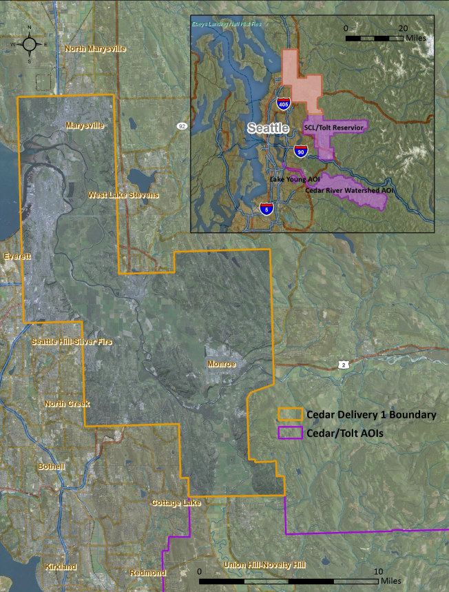
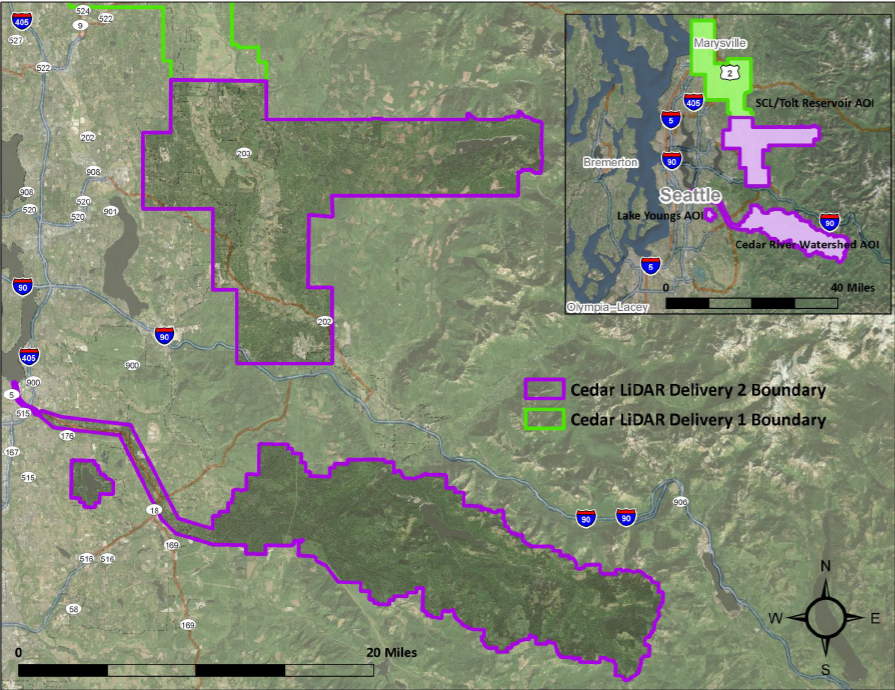
Description
This project covers the first and second delivery of the Cedar River Watershed Project. The first delivery covers a portion of the SCL/Tolt Reservoir--an area north of the City of Duvall to Marysville.  The second delivery covers the remainder of the SCL/Tolt Reservoir, Lake Young Reservoir, and the Cedar River Watershed and Floodplain area of interest. The data was acquired between October 2013 and July 2014. See the project reports below for more information.

Projection: Washington State Plane North (FIPS 4601)
Vertical Datum: NAVD88 Geoid03
Horizontal Datum: NAD83 (HARN)
Units: US Survey Feet

Reference Information

Quarter Quad Index (Shapefile)
LAS Tile Index (Shapefile)

Trajectory Files (Shapefile)
Frequently Asked Questions

Delivery 1
Project report
Bare Earth raster metadata
Top surface raster metadata


Delivery 2
Project report
Bare Earth raster metadata
Top Surface raster metadata

      
Data Download

Delivery 1


Raster Data
3ft raster resolution - 3.75' USGS quarter quads
Files Data Download Map Viewer
Bare Earth DEM - .e00 format
list
PSLC Data Download Viwer
Top Surface DEM - .e00 format list
Bare Earth Hillshade TIFF
list
Top Surface Hillshade TIFF
list
Bare Earth File Geodatabase Mosaic (2.7 GB)
gdbbutton
Top Surface File Geodatabase Mosaic (2.7 GB) gdbbutton


Point Data
.75 USGS quarter quads tiles*
Files


Bare Earth Point ASCII files list


LAS files- laszip compressed
list


Delivery 2


Raster Data
3ft raster resolution - 3.75' USGS quarter quads


Bare Earth DEM - .e00 format list


Top Surface DEM - .e00 format list

Bare Earth Hillshade TIFF list

Top Surface Hillshade TIFF list

Bare Earth File Geodatabase Mosaic (4.6 GB) gdb


Top Surface File Geodatabase Mosaic (4.7 GB) gdb


Point Data
.75 USGS quarter quads tiles*


Bare Earth Point ASCII files list

LAS files- laszip compressed list


*  The point data files are available as .75 quarter quad tiles.  For details on the subdivisions of this data see the Index shapefiles in the Reference Information section above.


Update Policy
As we approve data from the contractor they are posted here. Areas within many of the bare-earth DEMs can be improved by further processing of the all-return point data to better isolate bare-earth points. As we make these improvements we will upgrade the bare-earth DEMs and derivative images posted here.

Technical Assistance
If you have difficulty loading the data files into your software, cannot easily transfer large files via the Internet, or would like advice on the uses and limitations of these data, please reference our frequently asked questions.  If you can't find what you need here contact us.

This page is maintained by the PSLC webmaster .