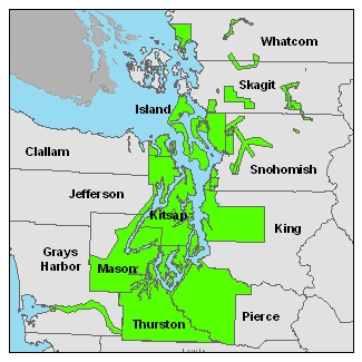
Data:
The raster data is available in either USGS quarter
quads and as a Mosaic. The elevation data in quarter
quads is in the ArcInterchange .e00 format. The
hillshade images in quarter quad are in georeference TIFF
format. The raster elevation data is also available as
a mosaic ArcGIS 9.x file Geodatabase. The file
Geodatabase includes raster datasets for the bare earth and
the top surface. The point data is available in ASCII text
format. Point data is only available by tile. A
tile is a 1/25 section of a USGS quarter quad. For
details on the subdivisions of this data see the Index
shapefiles in the Reference Information section above.
| Raster Data by USGS Quarter
Quad/Tiles |
Individual Files |
DEM Index Map |
Topographic Image
Index Map |
Bare
Earth - 6 ft raster resolution
|
 |
 |
 |
| Top Surface - 6 ft
raster resolution |
 |
 |
 |
|
|
|
|
| Raster
Mosaic Data |
|
|
|
| File
Geodatabase Mosaic |
 |
|
|
Contours**
|
|
|
|
5-ft Contours shapefile for
Bainbridge Island
|
|
|
|
** Prior to the PSLC, in 1999, there was a project over
Bainbridge Island. It was sponsored by Kitsap County
PUD. There are only Bare-Earth DEM's available for this
project. No point data. In lieu of the point data we
created 5-ft contours.
Bare Earth ASCII Files
The bare earth ASCII data is available by individual
project. Adjacent areas have not been merged. To
search and download the data follow the steps below.
If you have further questions see the Frequently Asked
Questions page.
Download Steps
1.
Download
the Project Coverage shapefile and the Tile Index
shapefile.
2. Using the Project Coverage
shapefile find the PSLC project and the sub-project that
covers your area. If your area is on the boundary
of two projects, you will need to download files from
both.
3. Using the Tile Index
shapefile find the quarter quad(s) and tile(s) that
cover your area.
4. From the list below, select
the project or sub-project you found in step 2.
Once there find the quarter quad(s) and download the
tiles for your area (from step 3).
List of LiDAR Projects and
Sub-Projects
PSLC2002
PSLC2003
PSLC2004
PSLC2005
All-Returns
ASCII
The All Returns
ASCII data is available by individual project. Adjacent areas have not been
merged. To download the data follow the steps
below. If you have further questions see the Frequently Asked
Questions page.
Download Steps
1.
Download
the Project Coverage shapefile and the Tile Index
shapefile.
2. Using the Project Coverage
shapefile find the PSLC project and the sub-project that
covers your area. If your area is on the boundary
of two projects, you will need to download files from
both.
3. Using the Tile Index
shapefile find the quarter quad(s) and tile(s) that
cover your area.
4. From the list below, select
the link for the project or sub-project you found in
step 2. Once there find the quarter quad(s) and
download the tiles for your area (from step 3).
List of LiDAR Projects and
Sub-Projects
PSLC2002
PSLC2003
PSLC2004


