FEMA
Dataset 2009
Geographic Area: Southwest
Washington along the coast of Pacific and Grays Harbor Counties
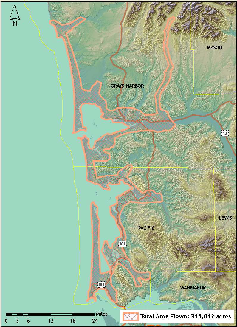
| This
dataset was acquired by FEMA through the Oregon LiDAR Consortium.
It was flown to similar
specifications as the PSLC data. The native projection for this LiDAR
collection is UTM Zone 10; horizontal and vertical datum: NAD83
(CORS96)/NAVD88 (Geoid03); units: meters. The DEMs
have a resolution of 1 meter
cells. Reference Information:
Project Report - pdf
Index for the grid (e00) and the
LAS tiles - shapefiles Download Data: All-returns points LAS files
Data will be uploaded soon filegeodatabase
2,575,847,076 bytes; for ArcMap 9.3; This version is bare-earth only filegeodatabase
8,785,425,604 bytes; for ArcMap 9.3; Includess bare-earth, highest-hit, and shaded relief of each WARNING: some versions of unzip cannot handle this big file. |