Puget Sound Lidar Consortium

Home | About Lidar | About the PSLC | Data | Uses of Lidar data | Links | Contact us


2017 Bainbridge Island
  map
   
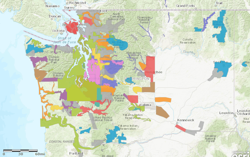
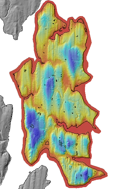
Description
This project covers Bainbridge Island, updating the groundbreaking and faultfinding 1997 survey. Bainbridge is a 35-minute ferry ride west of Seattle.

The data was acquired 07/03/2015 for
Gretchen Brown, CAD/Mapping Specialist
City of Bainbridge Island
280 Madison Avenue North
Bainbridge Island, WA 98110
by Quantum Spatial

Projection: Washington State Plane Northi FIPS 4601
Units: US Survey Feet
Vertical Datum: NAVD88 (GEOID12A)
Horizontal Datum: NAD83 (2011)

We hope to acquire the project report and trajectories soon.

LAS Tile Index and Boundary Shapefiles
Ground Control Shapefiles
Frequently Asked Questions

Data Download
Raster Data
3ft raster resolution
Files Data Project Map Viewer
Bare Earth & Top Surface DEMs & Hillshade Mosaic TIFFs, and Intensity Mosaic TIFFs list
PSLC Project Viewer
Click on our draft project viewer or
You can download the index shapefiles
Point Data
LAS files- laszip compressed
list


Update Policy
As we approve data from the contractor they are posted here. Areas within many of the bare-earth DEMs can be improved by further processing of the all-return point data to better isolate bare-earth points. As we make these improvements we will upgrade the bare-earth DEMs and derivative images posted here.

Technical Assistance
If you have difficulty loading the data files into your software, cannot easily transfer large files via the Internet, or would like advice on the uses and limitations of these data, please reference our frequently asked questions.  If you can't find what you need here contact us.

This page is maintained by the PSLC webmaster .