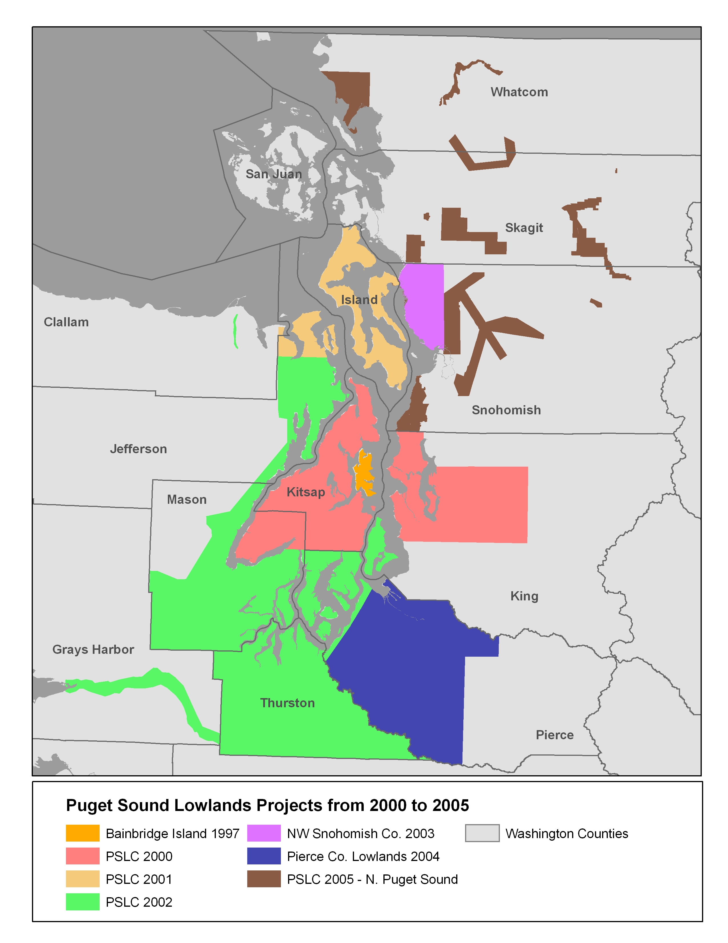
Flight Trajectory Files and Project Reports for the 2000-2005 Puget Sound Lowland Projects
Flight Trajectory files are available for most project. Project Reports are available for projects flow in 2005 only. Most of the trajectory files are in Shapefile format, but some are in plain text files. The project reports were provided by the LiDAR Vendor who surveyed and processed the data for the PSLC. You may also find the Puget Sound Lowlands Projects Map useful.
Back to Puget Sound Lowlands Projects Page
Finding the dates when data was flown
If you are trying to find the day a particular area was flown, use the Flightline Trajectory files. These have GPSweek and GPStime. GPSweek can be translated with the NGS GPS Calendar. To get the day of flight, use the GPStime which is in seconds. Each GPS Week has 604,800 seconds and each day has 86,400 seconds. If you just need the range of dates, take a look at the project report (when available).
Back to Puget Sound Lowlands Projects Page
Project Name
Flight Line Trajectory Files
Project Report (PDF)
2000 Kitsap Co and Seattle/eastside area.
Note: Not all flightlines have GPSweek and time
Trajectory
not available 2001-2002 Clallam Co, Jefferson Co and Island Co Trajectory
not available 2002 Thurston Co, Mason Co, Jefferson Co, Vashon Island,
and Pierce Co Peninsula
Trajectory not available 2002 Chehalis River
Trajectory not available 2002 Dungeness River
Trajectory not available 2002 Elwa River
Trajectory not available 2003 Snohomish County
Trajectory not available 2004 Pierce County Lowlands (mainland)
Trajectory not available 2005 City of Arlington
Trajectory
Report
2005 Cavanaugh
Trajectory Report 2005 City of Snohomish
Trajectory Report 2005 City of Edmonds
Trajectory Report 2005 Fisher Slough and Port Susan
Trajectory Report 2005 City of Lynnwood
Trajectory Report 2005 City of Marrysville
Trajectory Report 2005 City of Mt. Lake Terrace
Trajectory Report 2005 City of Mukilteo
Trajectory Report 2005 Nooksack River and Lummi Tribe
Trajectory Report 2005 Nooksack North Fork
Trajectory Report 2005 Sauk River North
Trajectory Report 2005 Sauk River South Trajectory not available
2005 2005 Sauk River - Suiattle
Trajectory Report 2005 Skagit and Bacon
Trajectory Report 2005 Skagit Environmental Bank
Trajectory Report 2005 Snohomish County
Trajectory Report