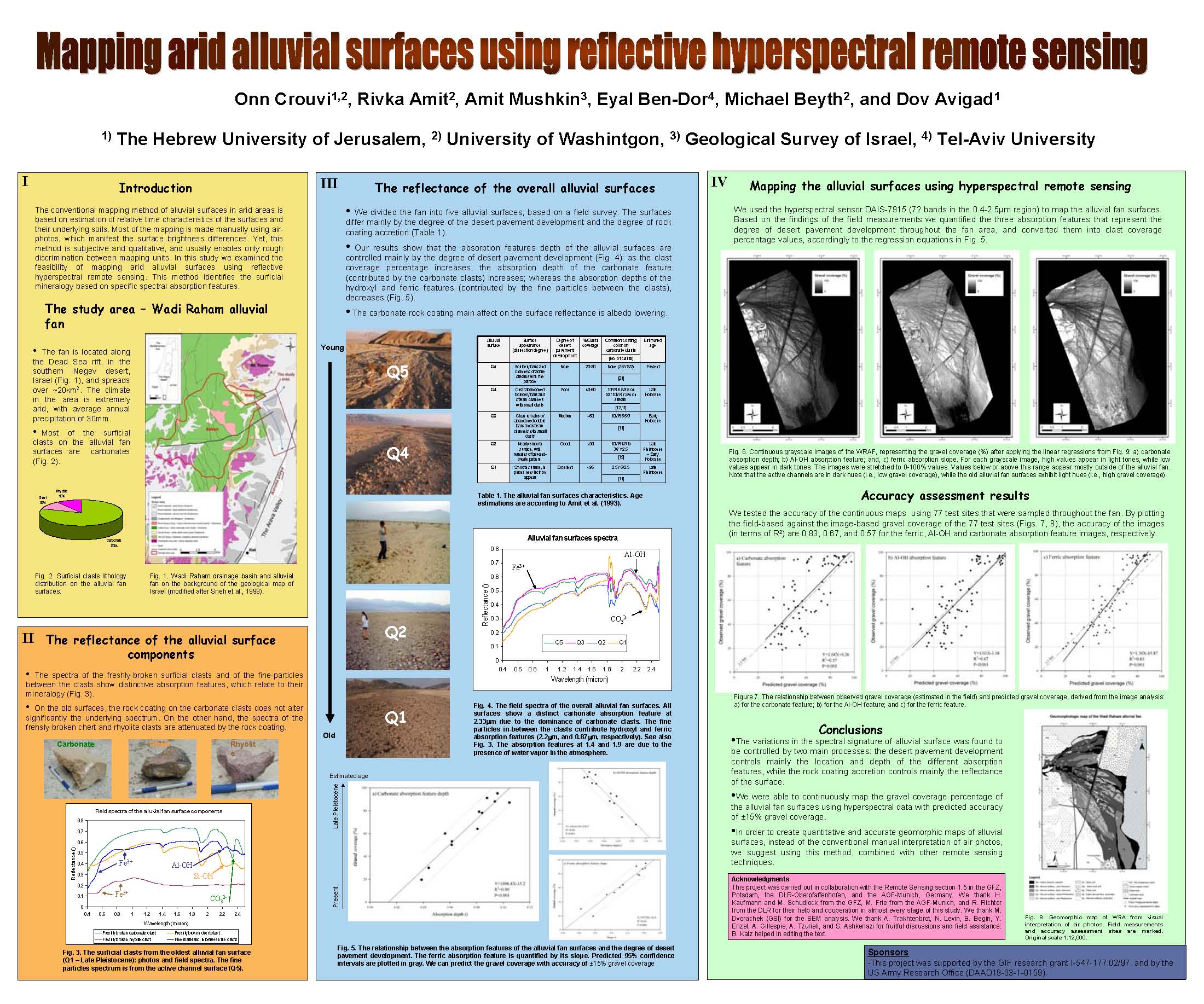
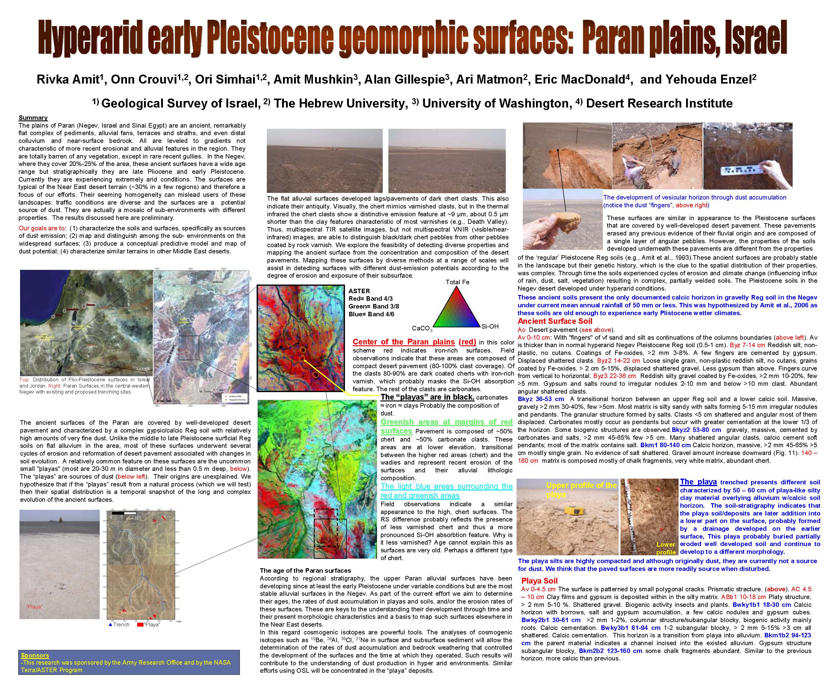
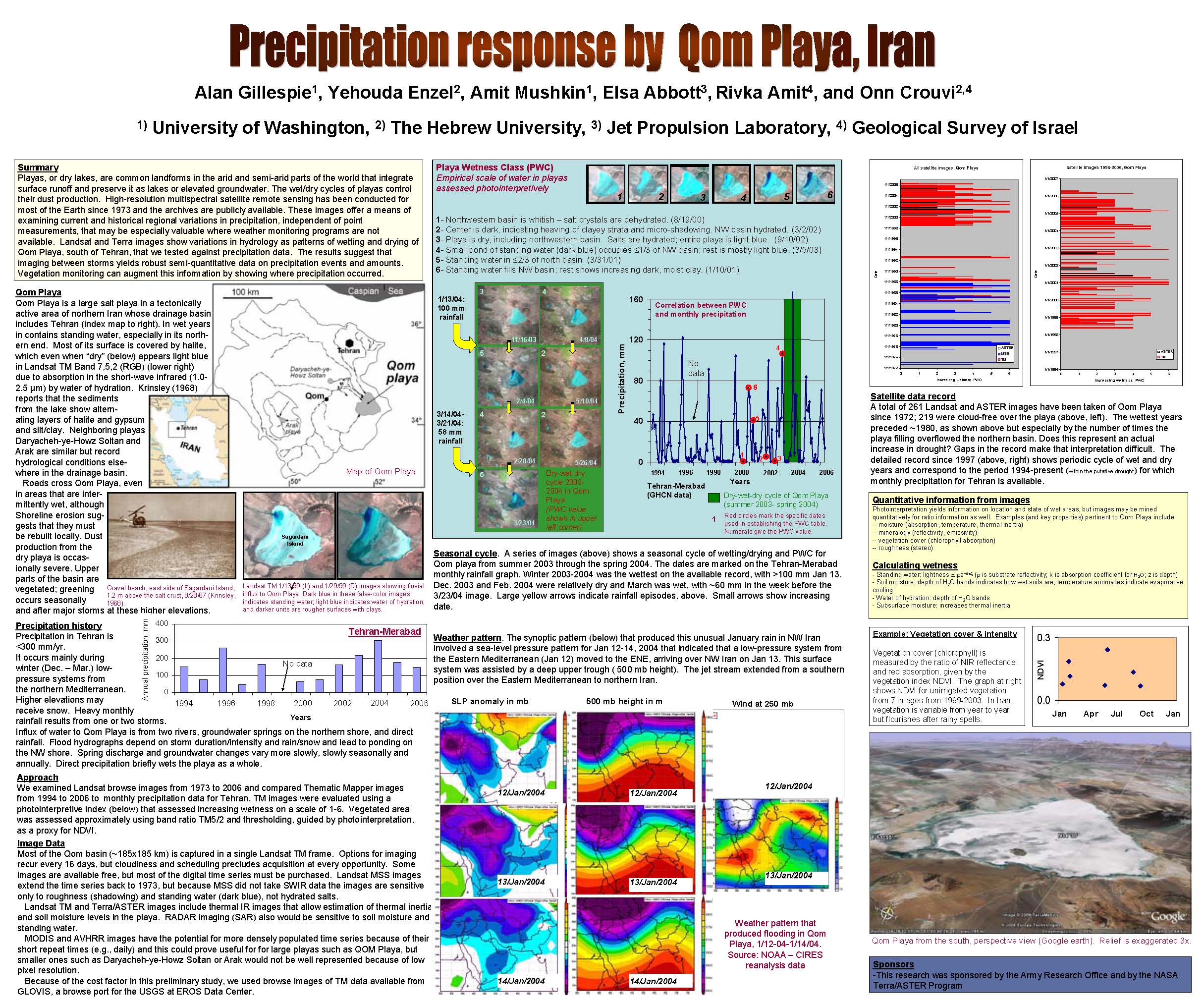
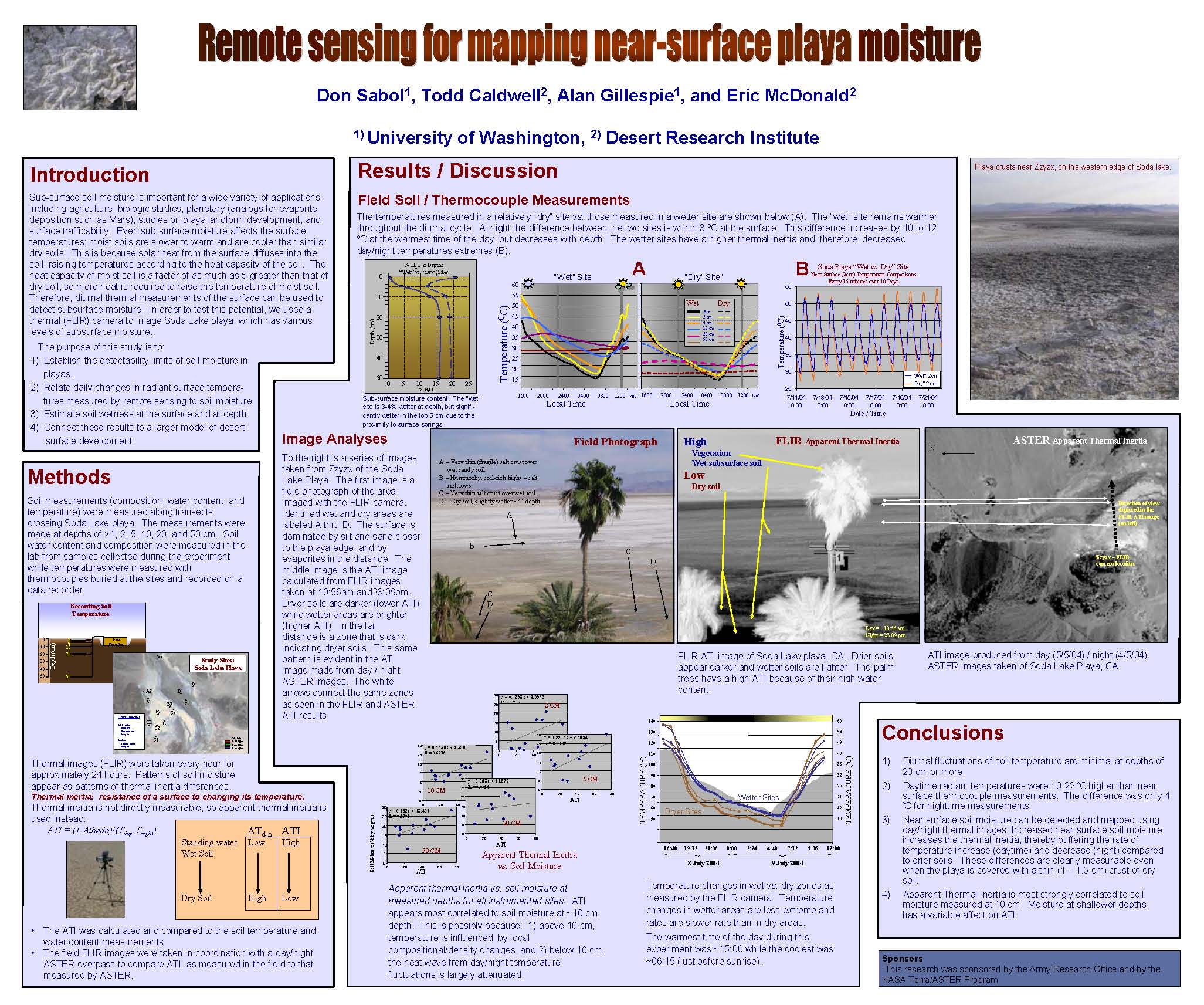
|
|
DRI
desert terrain project Overview

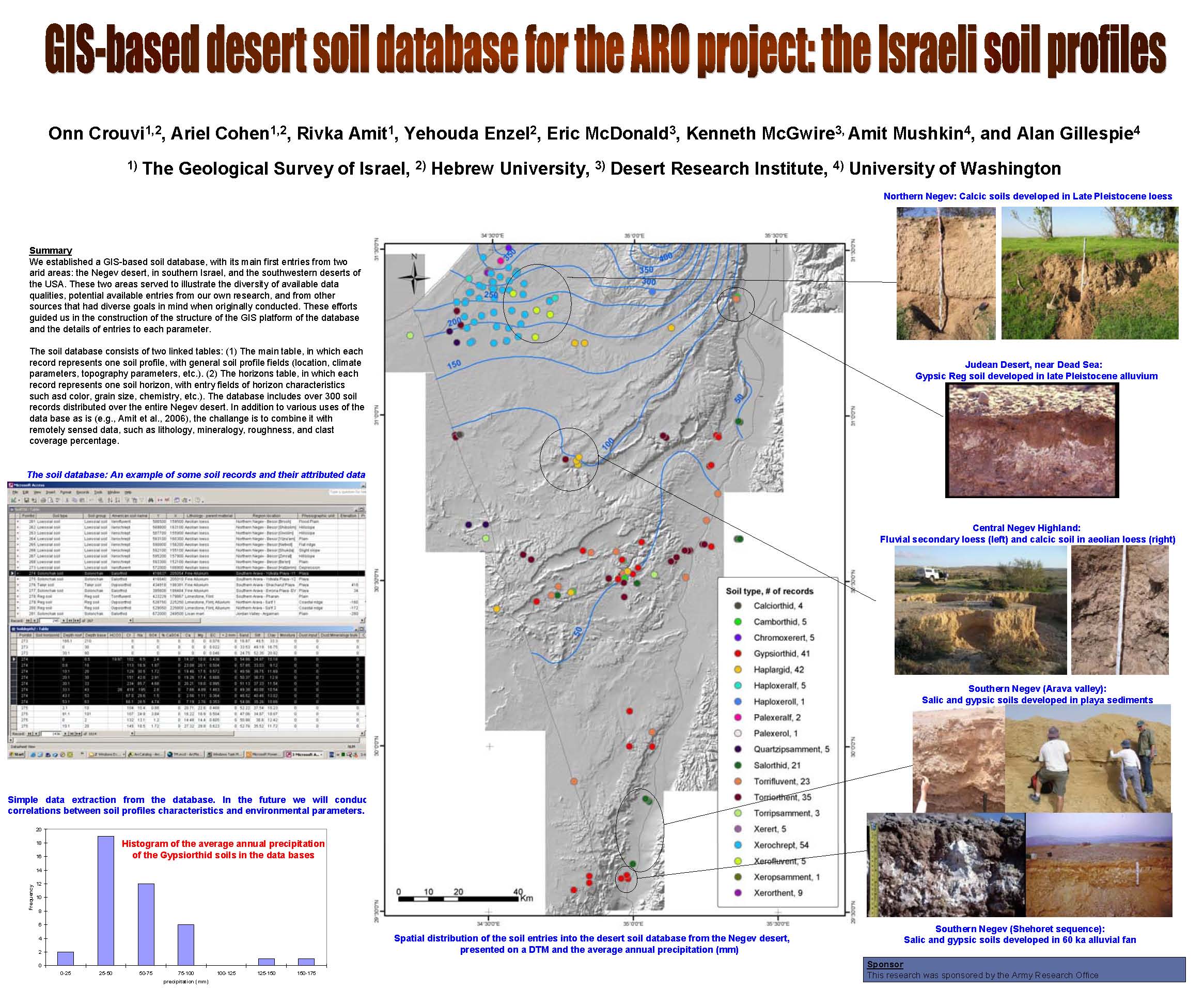
1. GIS-based desert soil
database
for the ARO project: the Israeli soil profiles
2. Lithologic mapping with
spectral
remote sensing
3. Parent
material mapping with ASTER
4. Parent
material
mapping
with
MASTER
5. Challenges in
compositional
mapping of playas, Yotvata Playa, Israel
6. Mapping arid
alluvial surfaces
using reflective hyperspectral remote sensing
7. Hyperarid early
Pleistocene
geomorphic surfaces: Paran plains, Israel
8. Precipitation
response
by
Qom
Playa, Iran
9. Prediction
desert loess
distribution using remote sensing and GIS techniques
10. Remote
sensing for mapping
near-surface playa moisture
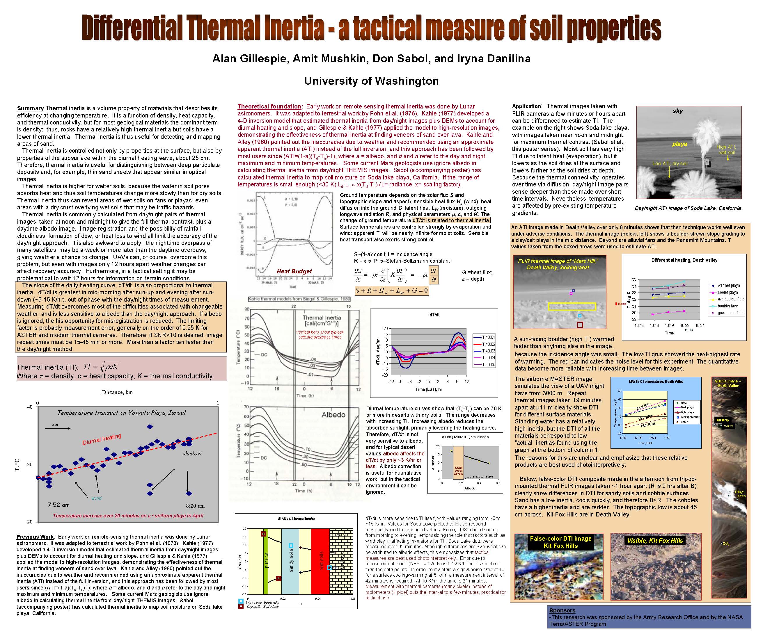
11. Differential
Thermal Inertia - a
tactical measure of soil properties
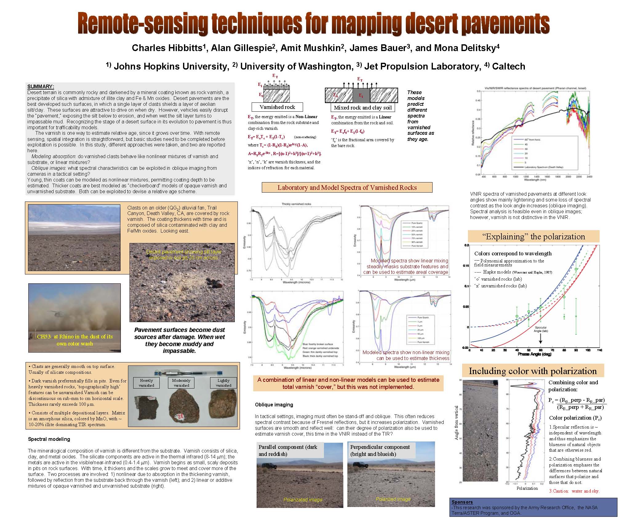
12. Remote-sensing
techniques for
mapping desert pavements
|