e00 files
nfstildem.zipnfstildem_fr.zip first returns
nwdem.zip
nwdem_fr.zip first returns
saukdem.zip
saukdem_fr.zip first returns
skydem.zip
snoqdem.zip
swdem.zip
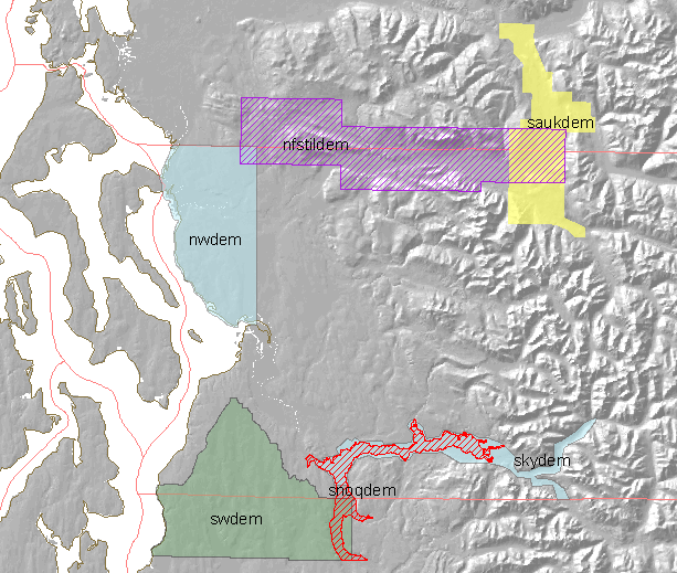
LiDAR-derived elevation grids
Snohomish County Information Services, March 2010, R.Simmonds

The folder LiDAR_4_PSLC contains the remaining bare earth and first return elevation grids
covering Snohomish County (e00 export format).  Grids ending in_FR are first returns, the remaining grids are bare earth.  Each grid name corresponds to the geography that is covers.  Here is the run down...

nfstildem - North Fork Stillaguamish floodplain

nwdem - NW Snohomish County

saukdem - Sauk River floodplain

skydem - Mainstem Skykomish River floodplain

snoqdem - Snoqualmie River floodplain

swdem - SW Snohomish Countys
The quality of this survey is not equal to the quality of some others.
|
e00 filesnfstildem.zipnfstildem_fr.zip first returns nwdem.zip nwdem_fr.zip first returns saukdem.zip saukdem_fr.zip first returns skydem.zip snoqdem.zip swdem.zip |