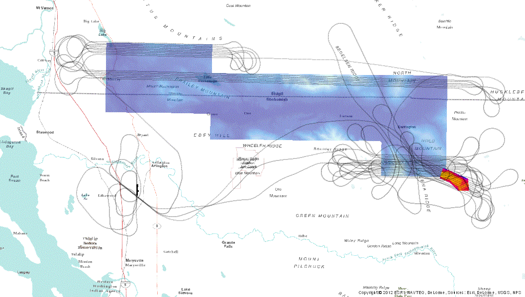
The vendor's report on Sauk South is not available, so Harvey has made an
image of the trajectory.
Oddly, the survey seems to comprise just the red-orange area
(comprising 4 tiles) to the right. (The blue area is the
USGS/NASA survey)
Bare earth ASCII points
are available.