Puget Sound Lidar Consortium

Home | About Lidar | About the PSLC | Data | Uses of Lidar data | Links | Contact us


2016KingCounty_Delivery_4b2 Other King County 2016 data
  map
   
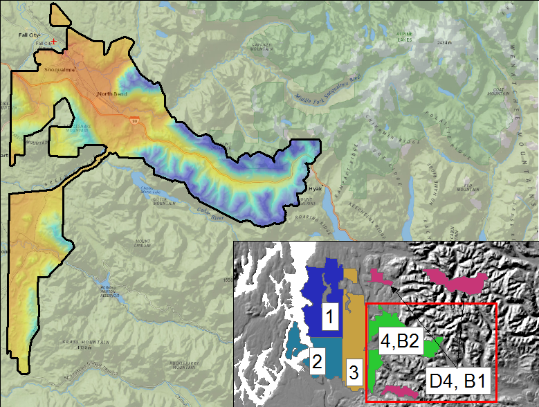
Description
This project covers portions of King County, including the South Fork Snoqualmie and the Cedar River watershed. The data was acquired March and May, 2016. See the project report below for more information.
Because final products were delivered in 2017, folder names may be confusing.
Projection: Washington State Plane North
Vertical Datum: NAVD88 (GEOID03)
Horizontal Datum: NAD83 (HARN)
Units: US Survey Feet


Reference Information

Full project report
Raster metadata
Boundary Shapefile
Quarter Quad Index Shapefile
LAS Tile Index Shapefile
Trajectory Point Shapefiles
Ground Control Shapefiles
Frequently Asked Questions
Data Download
Raster Data
3ft raster resolution
Files Data Download Map Viewer
Bare Earth DEM/Hillshade Mosaic TIFFs list
PSLC Data Download Viewer
Top Surface DEM/Hillshade Mosaic TIFFs list
Bare Earth filegeodatabase list
Top Surface filegeodatabase list
Intensity as quarter-quad tiffs list
Point Data
Files
LAS files- laszip compressed
list
ASCII XYZ files
list


Update Policy
As we approve data from the contractor they are posted here. Areas within many of the bare-earth DEMs can be improved by further processing of the all-return point data to better isolate bare-earth points. As we make these improvements we will upgrade the bare-earth DEMs and derivative images posted here.

Technical Assistance
If you have difficulty loading the data files into your software, cannot easily transfer large files via the Internet, or would like advice on the uses and limitations of these data, please reference our frequently asked questions.  If you can't find what you need here contact us.

This page is maintained by the PSLC webmaster .