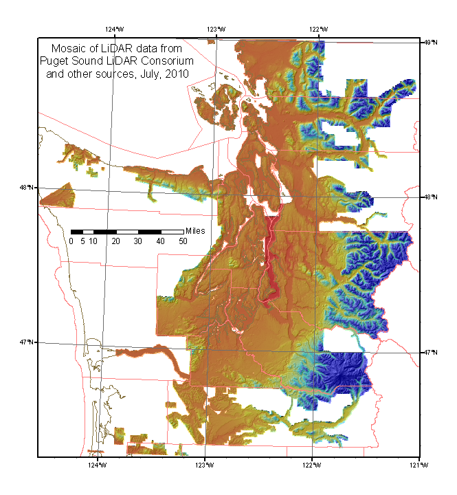
|
The January 27, 2011 version fixes a serious problem with the July version. A strangely inappropriate (smoothed data used to fill pinholes?) version of the Snohomish 2005-6 data had been used in July, and so it was overwritten.
A filegeodatebase is a directory with many (84 in this case) files of various sizes. Some of these files are larger than 4 gigabytes, and will break the compression program. Therefore you must
| location | date | agency | vendor | resolution | original projection | VDATUM | link | comment | |
|---|---|---|---|---|---|---|---|---|---|
| Snohomish County | 2005-6 | Sno County | 6 foot | State Plane North NAD83 | NAVD1988 | filegeodatabase and tiles | This layer should be near the bottom of the list, but it had to be recopied on the top (overwriting some more accurate data in places) because in was improperly processed the first time. |
||
| Quinault River above Lake Quinault | 2002 | Bureau of Reclamation/Quinault Tribe | Horizons, Inc. |
2 meter | UTM zone 10 NAD83 | PSLC | This will be part of the next version. | ||
| South Washington Coast | 2009 | FEMA/Oregon LiDAR Consortium | Watershed Sciences |
1 meter | UTM zone 10 NAD83 | NAVD88 Geoid03 | PSLC | This will be part of the next version. | |
| Snohomish River Estuary | 2009 | PSLC | 3 foot | State Plane North NAD83 HARN | NAVD1988 Geoid03 | PSLC | . | ||
| Lewis County 2009 | [2008/] 2009 | PSLC | Watershed Sciences |
3 foot | State Plane North NAD83 HARN | NAVD1988 | PSLC | This project was overlooked on the June supermosaic, but added in the July 2, 2010 version. | |
| Kitsap County 2000 | 2000 | PSLC | 6 foot | State Plane North NAD83 HARN | NAVD1988 | PSLC | Overlooked part of Puget Sound Lowlands data. | ||
| Olympic Peninsula | 2005 | Clallam County/DNR/DOT | 6 foot | State Plane North NAD83 HARN | NAVD1988 | PSLC | . | ||
| N Fork Skykomish River | 2009 | PSLC | 2 foot | State Plane North NAD83 HARN | NAVD1988 | Snohomish County | This project is not incorporated into the 30-foot mosaic. | ||
| Elwha | June, 2009 | ? | Entrix | 6 foot | State Plane North NAD83 HARN | NAVD1988 | (local) | ||
| Sauk | April, 2005 | DNR/Skagit County | Terrapoint | 6 foot | State Plane North NAD83 | NAVD1988 | report,
local copy of data |
The report describes the north half. | |
| Greenwater/White | 2007 | WaDOT | 3 foot | State Plane North NAD83 | NAVD1988 | all
data filegeodatabase |
not to be confused with DOT projects on SR401 in Yakima county. | ||
| Mount Rainier National Park | 2009? | NPS | 1 meter | UTM NAD83 | |
filegeodatabase | |||
| Lewis County | 2006 | PSLC | Watershed Sciences |
3 foot | State Plane South NAD83 | NAVD1988 | tiles filegeodatabase | ||
| San Juan Islands | 2008? | PSLC | 3 foot | State Plane North NAD83 | NAVD1988 | tiles filegeodatabase | with Lummi Island and Pt. Roberts | ||
| Skagit River/Bacon Creek | 2005 | PSLC | 6 foot | State Plane North NAD83 | NAVD1988 | tiles filegeodatabase | Sauk to Marblemount, plus lower Bacon Creek | ||
| bits near Skagit delta | 2005 | Skagit Environmental Bank | 6 foot | State Plane North NAD83 | NAVD1988 | filegeodatabase | |||
| Clallam | 2005 | PSLC | 6 foot | State Plane North NAD83 | NAVD1988 | filegeodatabase | |||
| Puget Sound Lowlands | 2000-2005 | PSLC | 6 foot | State Plane North NAD83 | NAVD1988 | tiles | These PSLC tiles are not broken down by project/year. | ||
| Lewis County | 2005 (winter of 2004-5) | PSLC | 6 foot | State Plane South NAD83 HARN | NAVD1988 | PSLC | (with parts of Lower Columbia 2005) | ||
| Skykomish | Sno County | 6 foot | State Plane North NAD83 | NAVD1988 | e00 | Overlaps Snoqualmie survey, extending higher | |||
| Snoqualmie | Sno County | 6 foot | State Plane North NAD83 | NAVD1988 | e00 | to King County line | |||
| King County | King County | 6 foot | State Plane North NAD83 | NAVD1988 | tiles | Includes SW Snohomish County and Puget Sound bathymetry | |||
| Darrington | 2003? | NASA/USGS | terrapoint | 6 foot | State Plane North NAD83 | NAVD1988 | filegeodatabase NASA | North Fork Stillaguamish | |
| Whatcom/Skagit | 2006 | USGS | Sanborn | 6 foot | State Plane North NAD83 | NAVD1988 | filegeodatabase tiles, LAS, metadata | aka North Puget Sound | |
| West of Rainier | 2006 | NASA/USGS | terrapoint | 6 foot | State Plane North NAD83 | NAVD1988 | filegeodatabase and links |