Puget Sound Lidar Consortium 1999-2000 data
Parent
| Home
| About
Lidar | About
the PSLC | Data
| Uses of Lidar data
| Links
| Contact us
LiDAR tiles have been mosaicked into large file geodatabases for
convenient use.
This filegeodatabase (.gdb) format can now be accessed through ESRI software
and a few other packages.
File geodatabases are more compact than
SDE databases and--when the user load is low--much faster.
(File geodatebases supplant "personal geodatabases".)
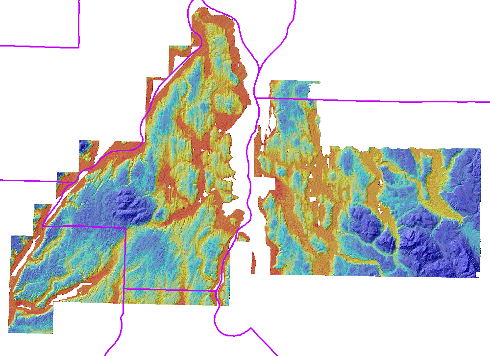
This is a combination of the PLSC2000 survey and the 1999 Bainbridge survey.
You see Kitsap County and parts of Mason and King Counties, including Seattle.
When the survey was published as
tiles
there were gaps of one to four cells between some tiles.
These gaps are fixed for the first time in this March, 2012 filegeodatabase.
Downloading 9 GB is complicated:
- Download the pslc2000 database
directory with its smaller files
and unzip it into the place where you want it.
- Then download
a00000034.gdbtable,
a00000039.gdbtable, and
a0000003e.gdbtable
into the pslc2000.gdb directory which you created
Warning: Older Internet Explorer has failed on files larger than 2
GB.
Netscape works. And very old FAT (new windows filesystems are NTFS)
filesystems cannot handle large files.
- Select the .gdb directory in ArcMap:AddData or in ArcCatalog. It
should contain three grids. Have fun with it.
- Delete partofgdb.zip (unless you had unzipped it on the fly)
Note:
- The Brainbridge survey did not include first returns or point data.
- Surveys include the surface of the land and the surface of the water.
The actual waterline depends on the tide at the moment that the aircraft
passes, and is not easily determined. We will work on this.
- Hydroflattening of inland waters requires a knowledge of lake elevation,
and trust that our water body water polygons are sufficiently accurate.
We have shied away from this process.
- Echo Lake is the only water body to be hydroflattened, as it was the
only small water body with no-data cells.
- Shaded relief pyramids were built with bininear resampling. This is not
the default, but it is the only reasonable option for shaded relief.
See the the
project page