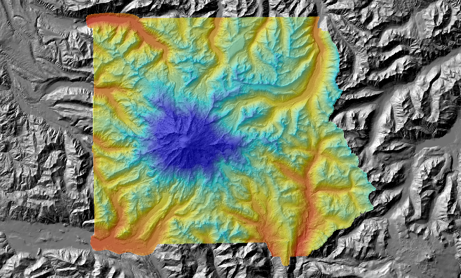
Bare earth LiDAR tiles have been mosaicked into large file geodatabases for convenient use. This format can now be accessed through ESRI software. Other vendors may have interfaces in their software for this format.
We have mosaicked only the bare-earth DEM and shaded relief. We now have the point data as 1290 laz files. The National Park Service has a zipped "grid" workspace, additional glacial data and metadata.
Download rainierlidar.gdb database directory zipped to 4123236205-bytes (~4 gigabytes)
Select the .gdb directory in ArcMap:AddData or in ArcCatalog. It should contain two grids. The shaded-relief image was built with the default elevation and azimuth of 45 and 135. Pyramids were created with bilinear resampling.
Watch out for crevasses!
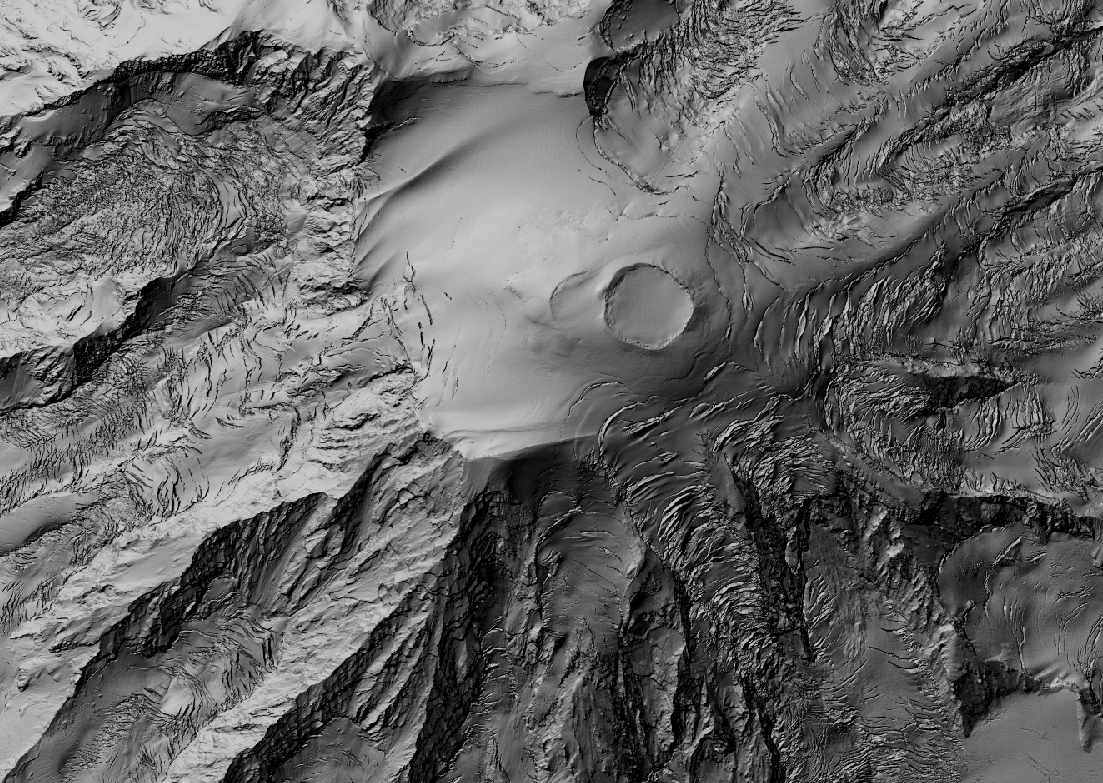
You can download this png file
or the georeferenced tiff version.
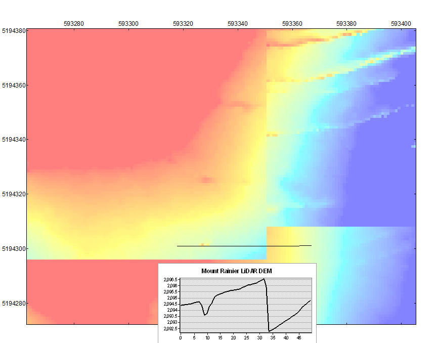
Warning: We recently discovered that there are jumps on some tile boundaries.
The DEM posted by the park service is also made from mismatched tiles, though they
seem to have been mosaicked in a different order. A close examination shows that these
jumps are differences in snow/ice depth bewtween flights Sept 2007, Sept 2008 and Oct 2008.