| Metadata
by Project (Project Map) |
Bare Earth DEM | Top
Surface DEM |
Bare Earth ASCII | All Returns ASCII |
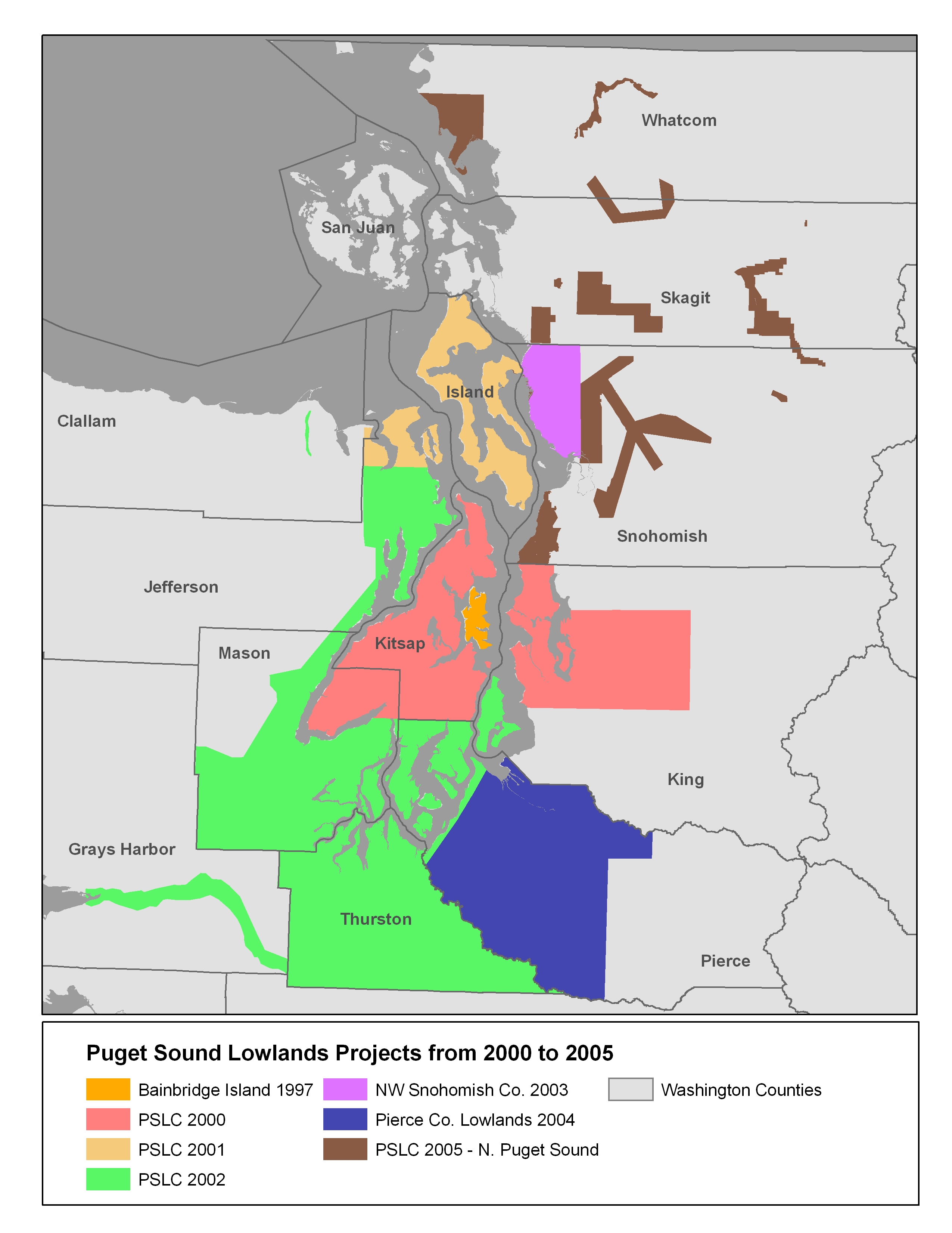
| PSLC 2000 Kitsap peninsula, Seattle and east to Snoqualmie |
 |
 |
 |
 |
| PSLC 2001-02 Island County, NE Jefferson County |
|
|
|
|
| PSLC 2002 Thurston County, Mason County, peninsual area of Pierce County, Vashon Island, SE Jefferson County, Chehalis River, Dungeness River |
|
|
|
|
| NW Snohomish County
2003 |
|
|
|
|
| Pierce Lowlands 2004 |
|
|
|
|
| North Puget Sound 2005 |
See Project Reports |
|||
| Olympic Peninsula 2005 |
See Project Reports | |||
| Clallam
County 2001 and
Bainbridge Island 1996-97 |
Readme.txt |
|||
Back to
2005-2005 Puget Lowlands Project Page
Disclaimer: We have taken
considerable care to ensure that these topographic survey data and
derived images are as accurate as possible. We believe most of these
data are adequate for determination of flood hazards, for geologic
mapping, for hydrologic modeling, for determination of slope angles,
for modelling of radio-wave transmission, and similar uses with a level
of detail appropriate to a horizontal scale of 1:12,000 (1 inch = 1,000
feet) or smaller and vertical accuracy on the order of a foot. Locally,
the data are of considerably poorer quality. Users
should carefully determine the place-to-place accuracy and fitness of
these data for their particular purposes. For many purposes a site- and
use-specific field survey will be necessary.
This page maintained by PSLC webmaster