Shaded-relief image of Seattle, 30-ft pixels (1.3 MB) with world file
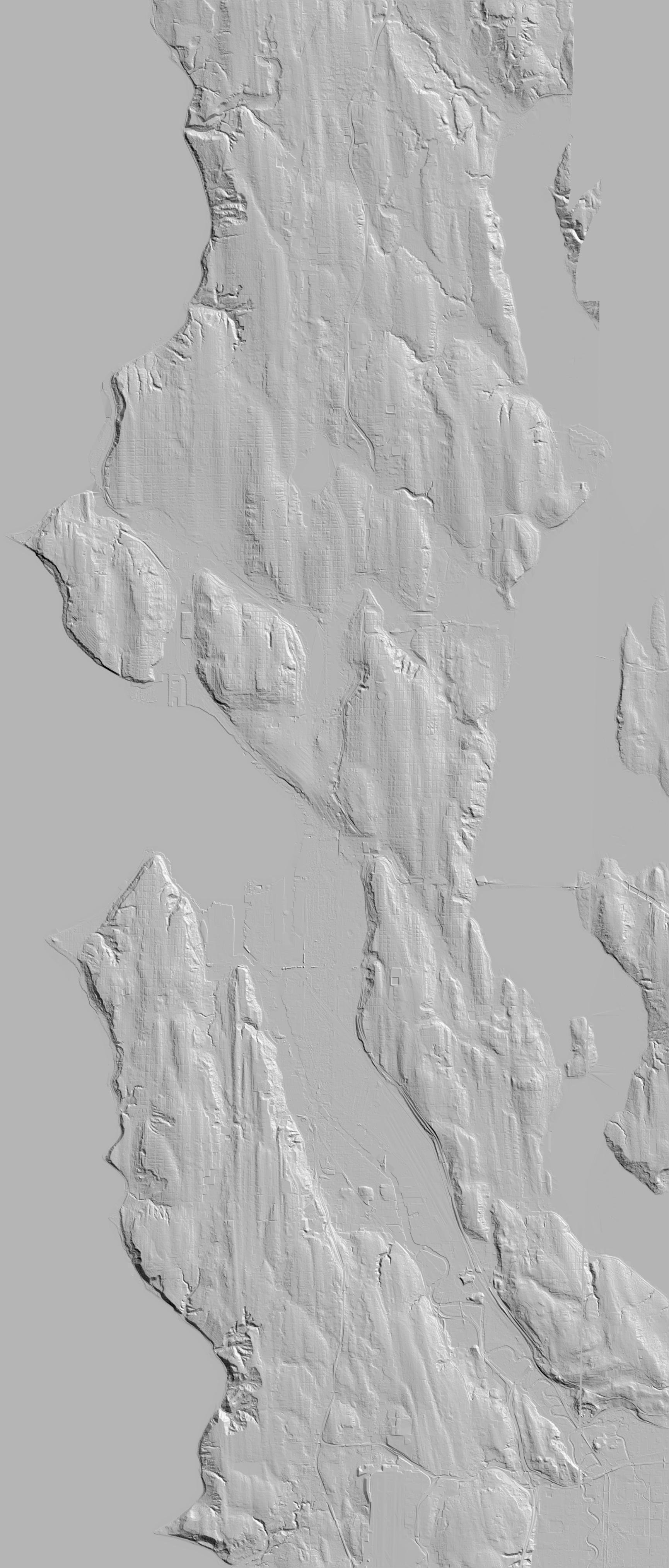
Shaded-relief image of South Puget Sound, 6-ft pixels, lower left (in State Plane Feet) (1077000,10002), upper right (1197000,700002) , 20000 pixels by 10000 pixels (15 MB) with world file
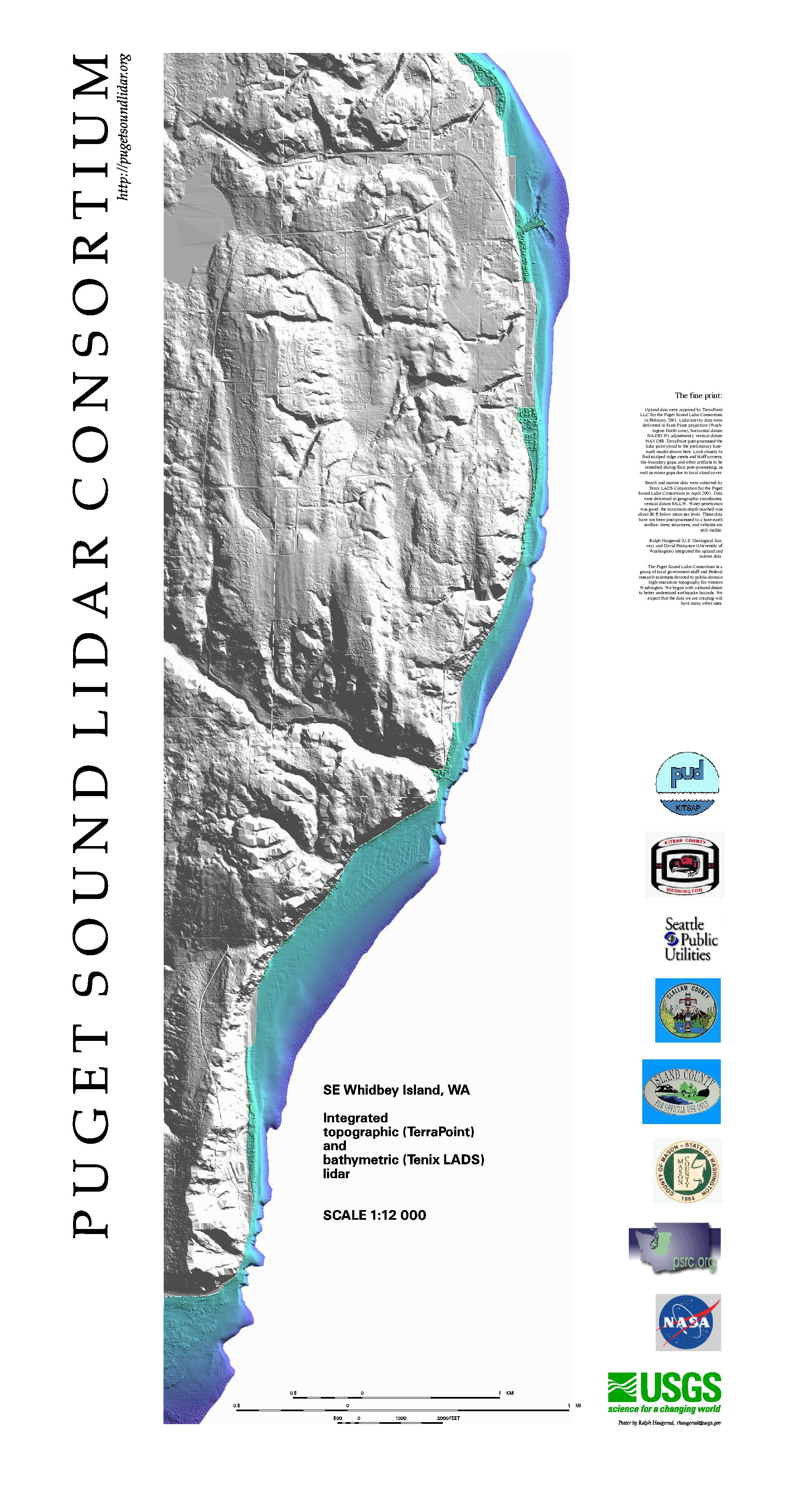
Poster of integrated terrestrial and bathymetric lidar, SE Whidbey Island
PDF file (329 KB)
JPG image (924 KB)
Zipped Postscript file
(for HP2500CP plotter) (6.5 MB)